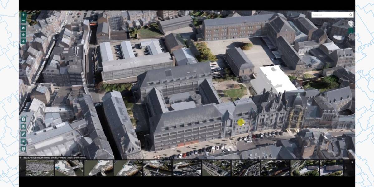
Monthly Archives: May 2018

Namur in 3D

2023-03-08T12:24:24+01:00

3D Cartography The City opens an open access 3D modeling platform for the entire municipal area. Some 45,000 buildings have been mapped. The model presents various themes such as a detailed relief model, a high-resolution aerial photograph (5cm pixel), textured 3D buildings (in LOD2 [...]

Namur in 3D2023-03-08T12:24:24+01:00

Storymap: The EU school fruit, vegetables and milk scheme

2023-03-08T12:24:25+01:00

The school scheme, funded through the EU Common Agricultural Policy (CAP), provides fruit, vegetables and milk to schoolchildren as part of a wider programme of education about European agriculture and the benefits of healthy eating.  The ESRI Story Maps App gives them the opportunity [...]

Storymap: The EU school fruit, vegetables and milk scheme2023-03-08T12:24:25+01:00

Model data connections and make predictions

2023-03-08T12:24:26+01:00

Insights for ArcGIS 2.3 released! Available now and hot off the software press! Insights for ArcGIS 2.3 is available with ArcGIS Online and ArcGIS Enterprise. What’s new? Great question. Glad you asked. Here are the key features… Link analysis allows you to establish relationships and view connections [...]

Model data connections and make predictions2023-03-08T12:24:26+01:00
Go to Top