ArcGIS Geostatistical Analyst
An extension for ArcGIS Pro and ArcGIS Enterprise
- Access an extensive toolbox
- Simplify model selection
- Collaborate and share results

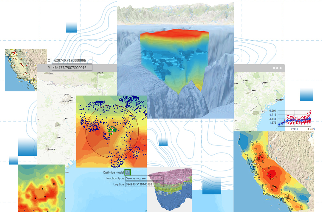
Extensive toolbox for spatial interpolation
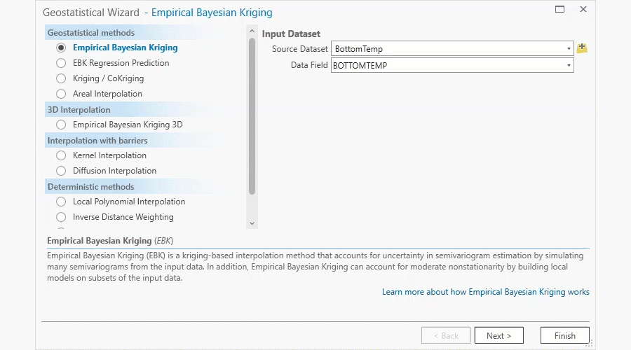
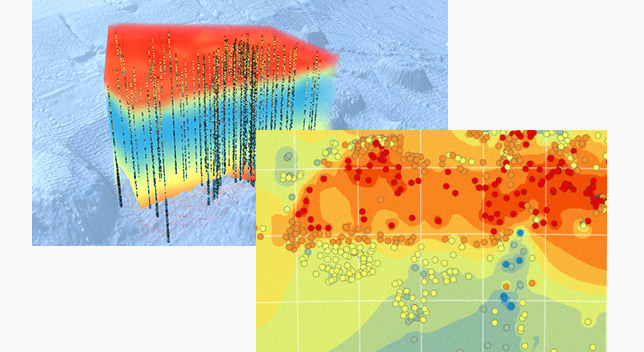
Fill in data gaps, create predictions, and provide a more complete understanding of spatial patterns with an extensive toolbox of deterministic and geostatistical interpolation methods. Validate your prediction results with the interpolation model and estimate the margins of error with built-in tools.
The following geostatistical interpolation methods are available:
- Inverse distance weighting (IDW)
- Interpolation with barriers
- Kriging and cokriging
- Empirical Bayesian kriging (EBK)
- EBK regression prediction
- Areal interpolation
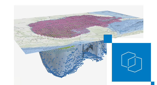
- Empirical Bayesian kriging 3D

Simplify model selection with automation
Save time and effort while receiving accurate and reliable results using automation. Use intelligent default settings to improve productivity and reduce mistakes. Find the most suitable prediction model with the automated selection process, which compares and interprets the model results.

Seamlessly collaborate and share results
Collaborate with others using ArcGIS Enterprise and ArcGIS Online to share prediction results and geostatistical workflows. ArcGIS Geostatistical Analyst seamlessly integrates spatial interpolation modeling within ArcGIS environments. It empowers you to answer critical questions about variable values and estimate uncertainties through analysis to support confident decision-making.
How it works
Explore data
Use maps and charts to examine the statistical and spatial properties of the input datasets to decide which interpolation models to use.
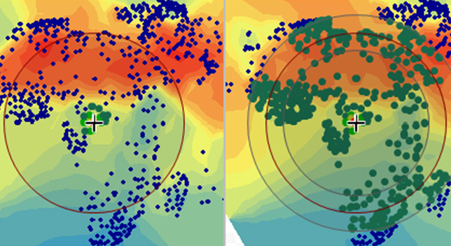
Model spatial correlation
Use a semivariogram to model spatial correlation in the input data, make predictions using the fitted model, and quantify the uncertainty.

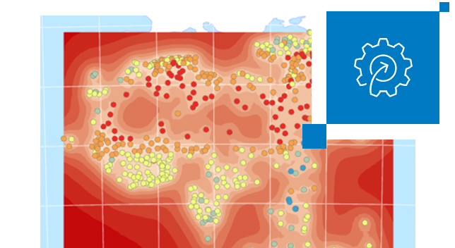
Validate and compare results
Create and fit multiple different candidate models and validate and compare the results using criteria to choose the best model.
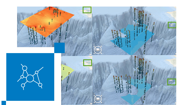
Share and communicate
Export your prediction results as contour lines, polygons, raster, and more to inform decision-making. Share analysis results and workflows within your organization.

Seamless integration with ArcGIS
ArcGIS Geostatistical Analyst is an extension available for ArcGIS Pro and ArcGIS Enterprise. Use advanced spatial interpolation methods powered by the ArcGIS system for reliable prediction and estimation.
ArcGIS Pro
Take advantage of data visualization, advanced analysis, and much more with ArcGIS Pro, a next generation desktop GIS.
ArcGIS Enterprise
Get started with ArcGIS Enterprise, the industry-leading geospatial technology.
Join the community
Exchange ideas, solve problems, and build relationships with the Esri Community for ArcGIS Geostatistical Analyst.
ArcGIS Blog
Read the latest tips, tricks, and best practices from the ArcGIS Geostatistical Analyst team.
Documentation
Learn how to get started with ArcGIS Geostatistical Analyst in ArcGIS Pro.
Tutorials
Experience what's possible through curated tutorials.
Pricing
ArcGIS Geostatistical Analyst is an extension for ArcGIS Pro and ArcGIS Enterprise. Explore pricing options and available extensions.