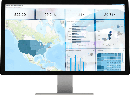
With the rapid advancements in technology, GIS is becoming increasingly indispensable in contemporary education and the professional world. Luc Zwartjes, a GIS teacher and trainer, shares his extensive experience and insights on integrating GIS into education and its impact on future careers.
Who is Luc Zwartjes?
Luc Zwartjes is a prominent figure in geography and geospatial education. He works at the Faculty of Sciences at Ghent University, where he is a lecturer and researcher within the geography department. His academic focus includes geophysics, physical geography, environmental geosciences, and geomatics (Research Explorer).
Zwartjes has an extensive background in integrating ICT into education, particularly in the field of geography. From 1986 to 2016, he taught geography, significantly contributing to the development and implementation of geospatial thinking and literacy in secondary education. He is involved in various Erasmus+ projects, such as the GI Learner project, which aims to promote geospatial thinking in school curricula.
Additionally, Luc Zwartjes plays a key role in the European Association of Geographers (EUROGEO), where he serves as treasurer and vice president. This organization is dedicated to promoting geographic education and supports various international projects and collaborations (Eurogeography).
Zwartjes’ contributions to the academic and educational fields are marked by his numerous publications on geospatial thinking, personalized learning, and the use of cloud computing in education (Research Explorer).

A window to the future: GIS in the classroom

With two decades of experience, from the early steps with ArcGIS 3.2 to now promoting the use of GIS in lessons, Zwartjes illustrates the evolution of GIS in education. “It started with GIS in computer classes, which was always a more complex organization in a school, but thanks to the rise of BYOD, it has developed into an integral part of the curriculum. Tools like ArcGIS Online have become indispensable,” he says.
His involvement in GIS education grew as the need for training increased. Throughout Flanders, he has trained teachers to effectively use GIS in the classroom.
The importance of GIS in contemporary education
According to Zwartjes, GIS is fundamental in current education due to the new educational standards that mandate its use and its increasing application in professional life. “Interest among teachers is growing, and more support is needed,” he notes, emphasizing that GIS is not limited to geography but also integrates with STEM projects and other educational fields.
A solid foundation in GIS in secondary education can encourage students to choose higher education programs that include GIS, thereby reducing the workforce shortage.

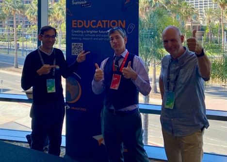
Photo taken at EDUC 2023 with Rafael De Miguel González (EUROGEO President), Joseph Kerski and Luc Zwartjes
Technological advances and GIS
With the introduction of curricula that include GIS, its use in education is structurally anchored. The minimum goals and geography curricula mandate the use of GIS as a research tool in every year. Zwartjes points to tools like ArcGIS Online, StoryMaps, and Survey123 as essential instruments for students. Technological developments, including the availability of laptops for students, have significantly facilitated the integration of GIS into education.
Zwartjes emphasizes the importance of skills such as analyzing and interpreting maps. He provides examples of how students, through projects like analyzing flood risks, not only learn about geographic data but also about demographics and climate change.
Career, open-source and the future
Many graduates apply GIS in their professional lives, ranging from engineers to geographic information specialists. Zwartjes sees the future of GIS in both education and business positively, with increasing integration beyond traditional fields like geography or geospatial studies.
Regarding the role of open-source GIS tools versus platforms like ArcGIS, Zwartjes says that although some colleagues use alternatives, the platform-independent nature of ArcGIS Online is a significant advantage. “Many schools work with tablets or Chromebooks where installing software is an issue; online tools are a blessing for this.” He sees a growing trend in the use of scene viewers, which will further expand the possibilities for educational and professional use.
Advice for GIS enthusiasts
Zwartjes encourages those considering GIS to persevere. “Once you master the basics, a whole new world opens up,” he says. He advises using online platforms and resources such as Esri Training, GI Learner, and GI Pedagogy to deepen knowledge.
At the end of our conversation, Luc emphasizes the value of GIS in education and business. He highlights that while the journey with GIS can be challenging, the rewards—in terms of knowledge, insight, and career development—are immense. With his passion and expertise, Luc Zwartjes remains a driving force in the field of geospatial technologies, passing on his vision of a better-connected and understood world to the next generation of explorers.

