
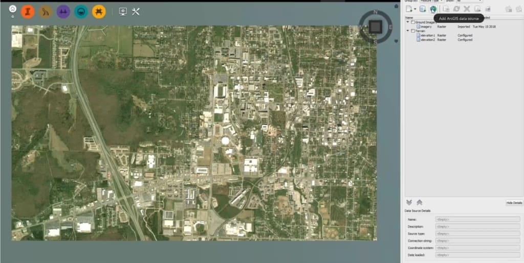
Access to masses GIS Data
Esri and Autodesk have entered into a global alliance in which the two worlds of CAD and GIS complement each other. ArcGIS gives you access to masses of geo data that you can now easily integrate into your CAD environment. Open data and government data can now be opened and visualized with a few clicks.
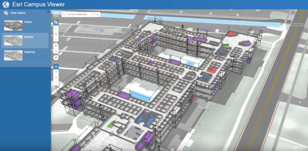
BIM in a few clicks and 3D Full power
3D building data, Revit files, … read this in your ArcGIS Pro and create your BIM with a few clicks. Manage assets, create floor plans, create routings, … Make your 3D data available to your customers via your own sites. Give them the possibility to manage and analyze these data (line-of-sight, shadow calculation, dimensions in 3D, …)
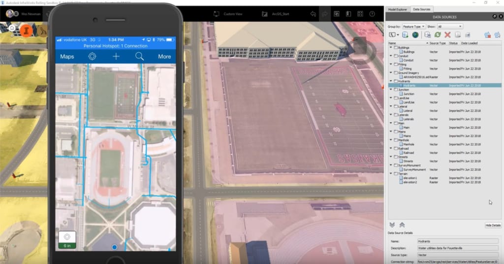
The Power of Mobile GIS and Drones
ArcGIS has a complete mobile application suite. Combine Infraworks with ArcGIS Online and immerse your information in the field via your smartphone, tablet or specialized collector and manage the information in real time.Drone2Map integrates the power of the drone data with ArcGIS so you can quickly and efficiently create your orthos, you 3D point Cloud can build and manage on the ArcGIS platform. Then integrate this data into your GIS or CAD or make it available to your end customers as a web application.
More info on: https://www.esri.com/landing-pages/autodesk-esri-strategic-alliance


Wat zijn de voordelen van een webinar?
U verlies geen tijd, u volgt immers de webinar van achter u computer.
Geen reiskosten en verblijfkosten.
Deelname is gratis, je hebt enkel een computer en een internet connectie nodig.