
A USER-FRIENDLY PLATFORM FOR SHARED FOREST USE
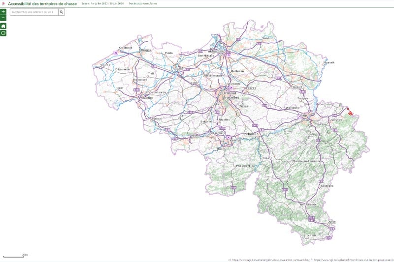
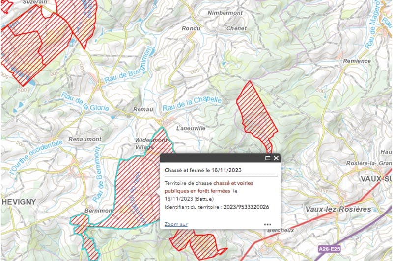
ChasseOnWeb.be is a webpage featuring an interactive map that, by date, displays the hunting areas that have obtained the right to close public roads in the forest for security reasons. This page is intended for all forest users to promote their collaboration in a friendly manner. Thanks to the user-friendly Esri products, the Walloon Public Service for Agriculture, Natural Resources, and Environment (SPWARNE) only took a few days to develop this.
The core team
The core team responsible for the project at SPW consisted of a small number of people: Boris Delfosse, responsible for cartography at the Department of Nature and Forests, Marie Wénin, geographer and geomatician in the SIG cell of SPWARNE who coordinated the work, two specialists in hunting, and hunting advisory committees, and Benoît Thirionet, responsible for databases and statistics at DNF. Around this ‘core,’ about twenty participants in total played a role in this initiative at some point.

Prior Modernization for Data Collection
Although the project was launched in 2020, it’s important to note that the development of the chasseonweb.be platform itself took less than a week. However, the collection and centralization of correct and precise data, both geographical (boundaries of hunting areas) and alphanumeric (closing dates), required significant modernization efforts within the administration. This included, among other things, creating electronic forms for requests to close hunting areas, as well as setting up a user-friendly internet platform allowing hunting committees to correct the data of hunting areas themselves (= crowdsourcing), which took about 3 years of work.
Esri Products: Great User-Friendliness
Marie Wénin is familiar with Esri products, partly because she uses them regularly—the Walloon region has had a framework agreement with Esri for several years—and because she is also responsible for training SPW staff in their use. “What I particularly appreciate is the user-friendliness of these solutions,” she explains. “Once certain of having the right data—accurate and updated boundaries of hunting areas and the database containing closing requests that is automatically fed by the forms—we were able to dynamically link these two data sources within ArcGIS Pro, Esri’s desktop tool.”
Subsequently, for public dissemination, the project manager can use Esri’s online tools available on Argis Online or Portal for ArcGIS, allowing hosting of information on one or more web pages. “In the case of ChasseOnWeb, we used the online portal,” clarifies Marie Wénin, adding: “We deliberately chose to create a webpage rather than a downloadable app because we wanted to limit barriers to the use of the platform as much as possible. We even bought the domain chasseonweb.be to avoid users having to enter a too complex URL. By simply entering chasseonweb.be, the citizen is redirected to the SPW/Esri portal where they find the most recent, perfectly updated information. And this regardless of the device on which they perform their search, whether it’s a computer or smartphone, as the page is responsive and therefore automatically adapts to the screen size.”

A Successful First Season
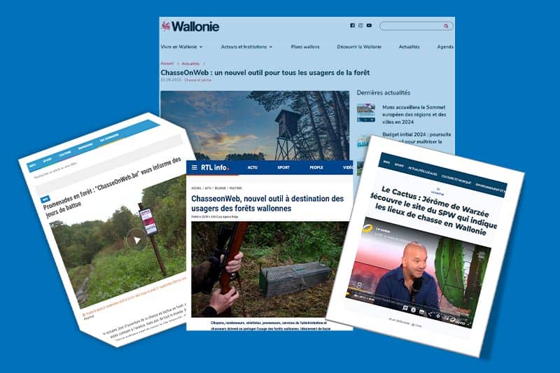
Launched on September 20, 2023, at the opening of the hunting season this fall, the platform is praised by both users and the media. Among the press articles and TV reports, we see, for example, that of TV Lux, which clearly explains the benefits of ChasseOnWeb for the friendly use of the forest by hunters, walkers, and professionals in the forest sector.
With 158,000 views to date and an average of 1,500 views per day, the project is a real success. “The statistics show very consistent use of the platform,” rejoices Marie Wénin. “This consistency and recurrence of consultations prove that the citizen trusts the provided data, finds it interesting, and that the system works well.” On the other hand, the URL of the webservice used by ChasseOnWeb is also compatible and used by sites such as ‘Partageons la forêt’ and could be used by any app—Strava, for example—that wants to have the information the platform provides: “This URL adds, in a way, ‘a layer’ of relevant information for users of the app in question,” explains the geomatician.
Supporting Solutions for Many Stakeholders
Speaking of this overlay of information layers, Marie Wénin emphasizes the importance of the capacity that Esri solutions offer: “Crossing data makes it possible to establish their spatial relationship, see their positioning in relation to each other, and draw the necessary conclusions.” An example of this is using the location layer of container parks, which allows one to see where they are located in Wallonia, their proximity to each other, and by overlapping this information with data on municipal population density, it can be determined whether there are enough parks so that all residents have one nearby.
This ability to cross data is therefore very interesting for many projects developed within the SPW or any other organization that wants to “facilitate the creation of interactive maps, the realization of spatial analyses, or field surveys,” concludes Marie Wénin.