

Latest GIS-tips

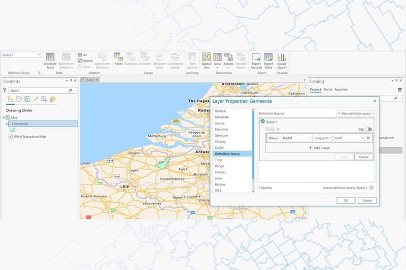
Filter data WFS in ArcGIS Pro
Discover the possibilities Sometimes it can be helpful to apply a filter to our layers, so that only a subset of data [...]

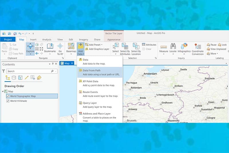
XYZ Tile layers in ArcGIS platform
What are XYZ tile layers? XYZ tile layers are layers comprised of multiple tiles that are situated on a server and are [...]

Using styles in ArcGIS Pro
Discover the possibilities A style is a collection of symbols, colours and other layout elements of layers and maps. The symbols and [...]

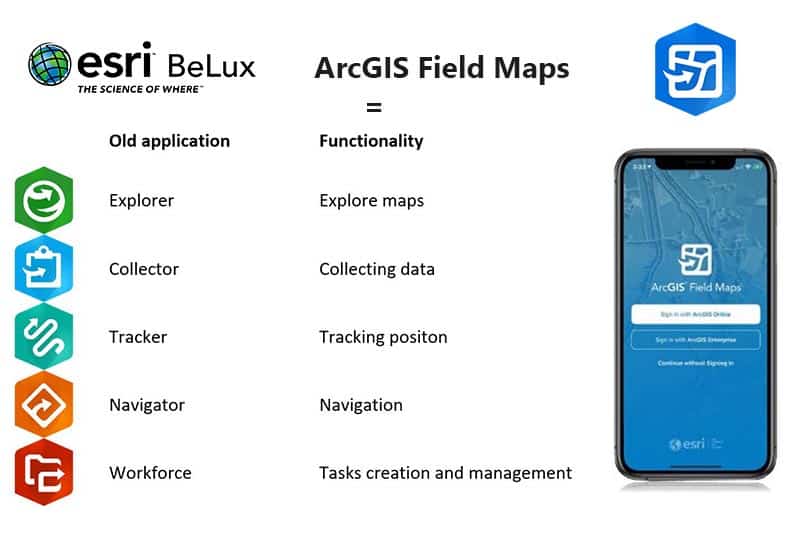
ArcGIS Field Maps : The all-in-one app for fieldwork
Discover the possibilities ArcGIS Field Maps is a mobile application which brings together map viewing, data collection and location tracking. It makes [...]
Our latest events about GIS

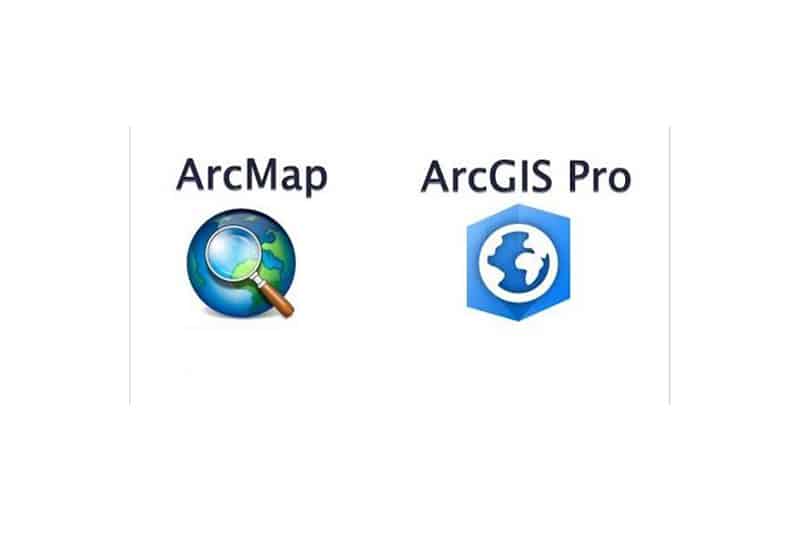
Webinar – Migrate from ArcMap to ArcGIS Pro
FREE WEBINAR Many of you have not yet switched from ArcMap to ArcGIS Pro. Time to help you take this step! With a [...]

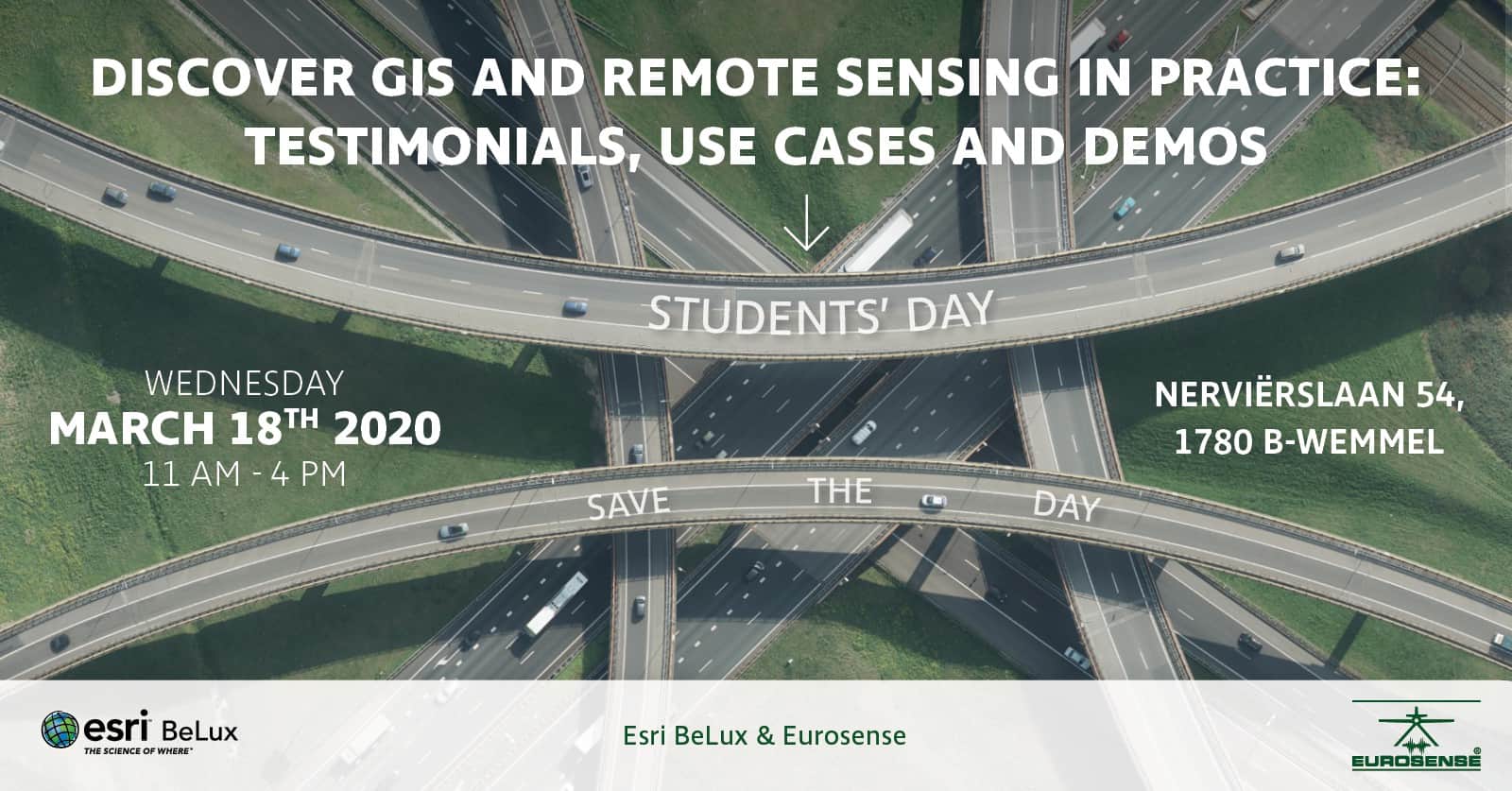
Be there on our Student’s Day
Together with Eurosense we organise a specific day for students to discover GIS and remote sensing in practice. Where: Nerviërslaan 54, 1780 Wemmel [...]

Trefdag Digitaal Vlaanderen 2019
Thank you to all who attended the Digital Flanders Meeting Day last Thursday and especially thanks for your useful feedback! A very interesting day [...]

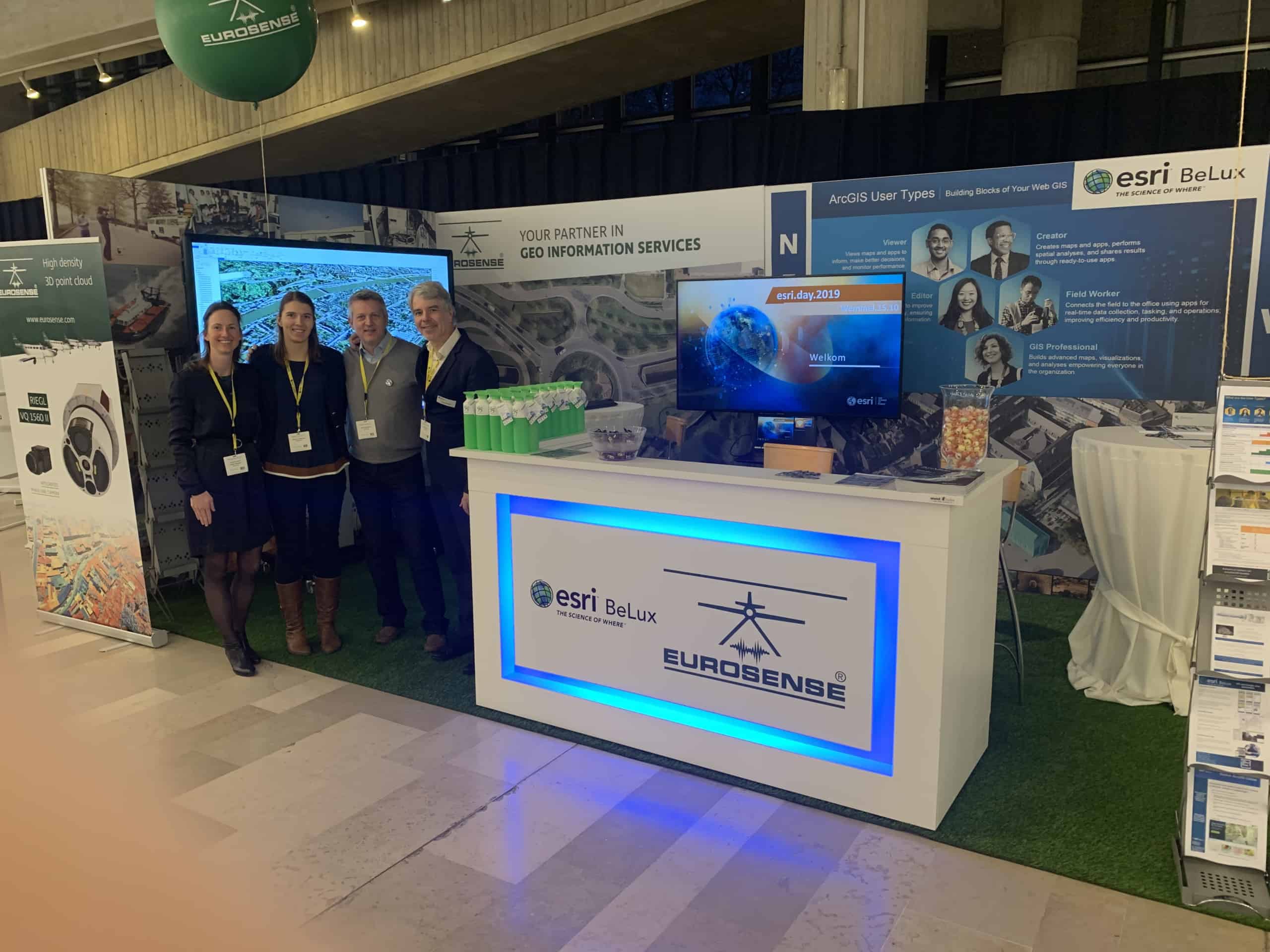
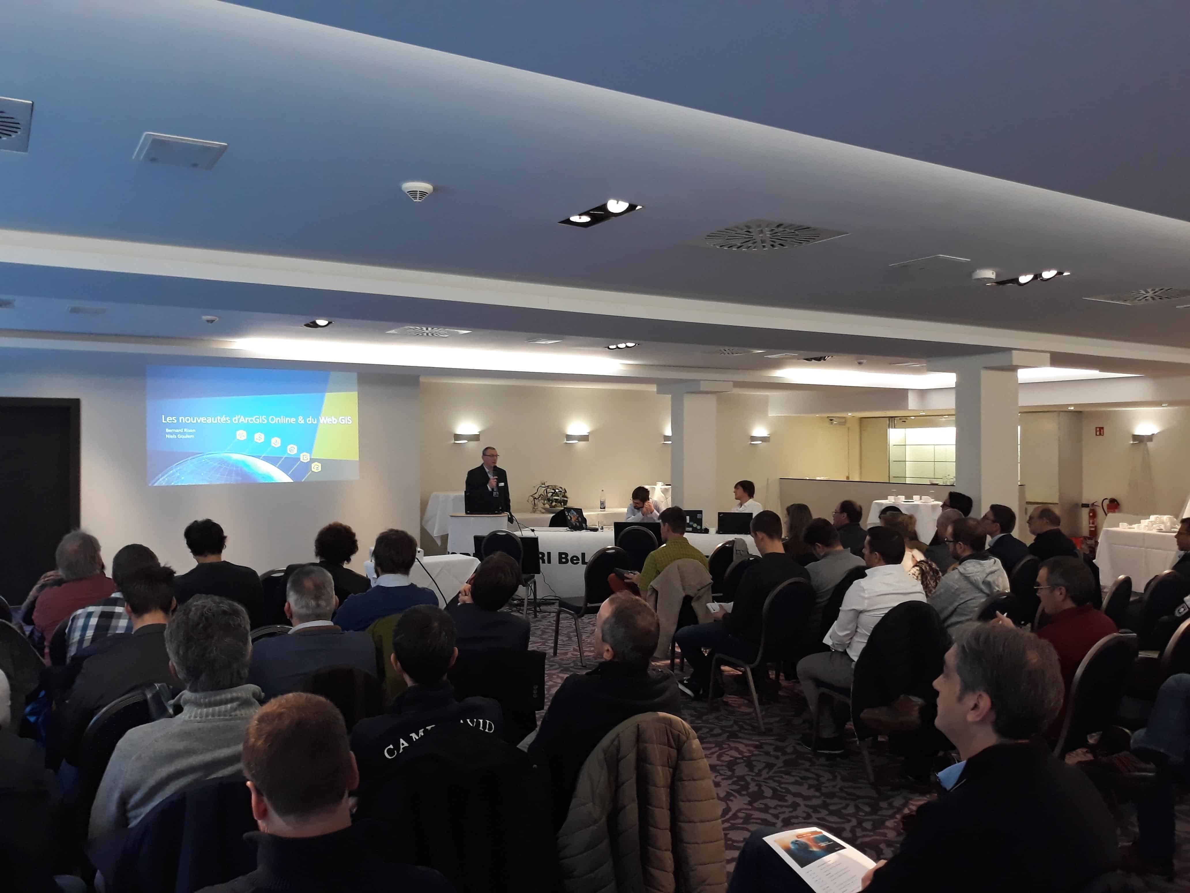
Esri Days 2019 in Luxemburg
A Great Day The Esri Days 2019 in Parc Hotel Alvisse were a success. Thank you to all participants and to all our [...]
Discover more GIS news

Save up to 40% thanks to the KMO portefeuille
In the fall of 2018, we offer you the opportunity to follow a GIS training and to recover a large part of your [...]

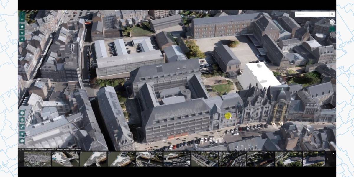
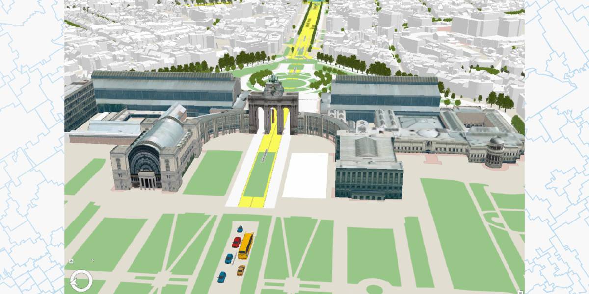
Namur in 3D
3D Cartography The City opens an open access 3D modeling platform for the entire municipal area. Some 45,000 buildings have been mapped. The [...]

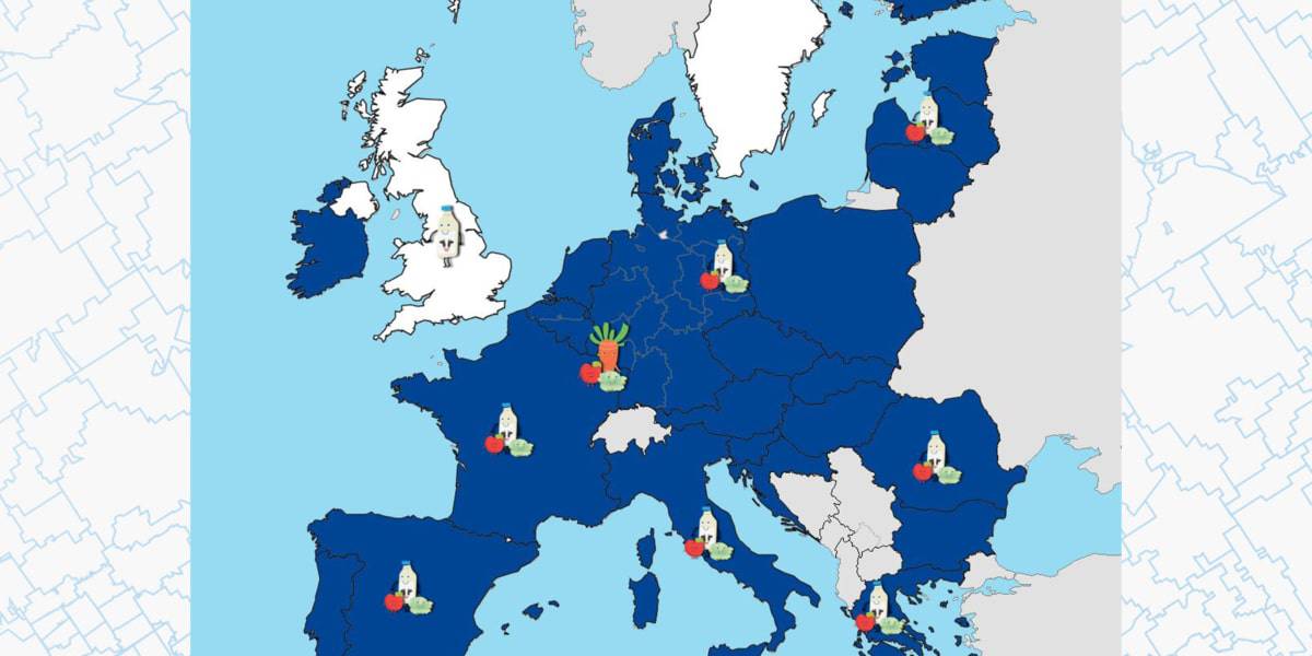
Storymap: The EU school fruit, vegetables and milk scheme
The school scheme, funded through the EU Common Agricultural Policy (CAP), provides fruit, vegetables and milk to schoolchildren as part of a wider [...]

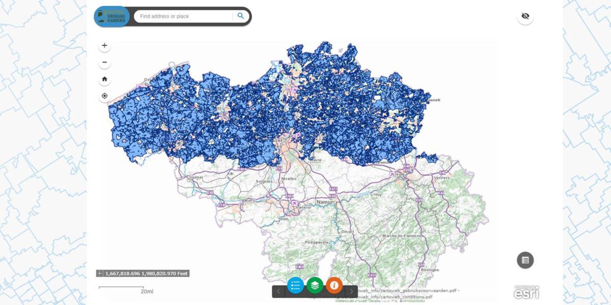
Flemish hunting grounds
Pioneering role Hubertus Vereniging Vlaanderen vzw has played a pioneering role since 2007 in digitizing the Flemish hunting grounds. It is thanks to [...]

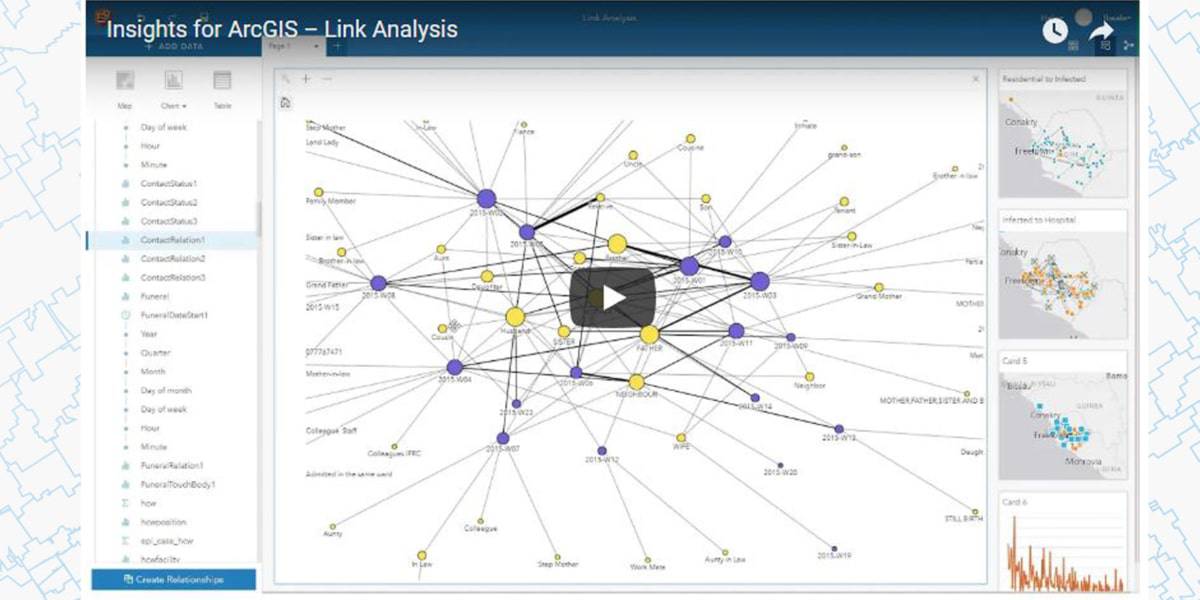
Model data connections and make predictions
Insights for ArcGIS 2.3 released! Available now and hot off the software press! Insights for ArcGIS 2.3 is available with ArcGIS Online and ArcGIS Enterprise. [...]

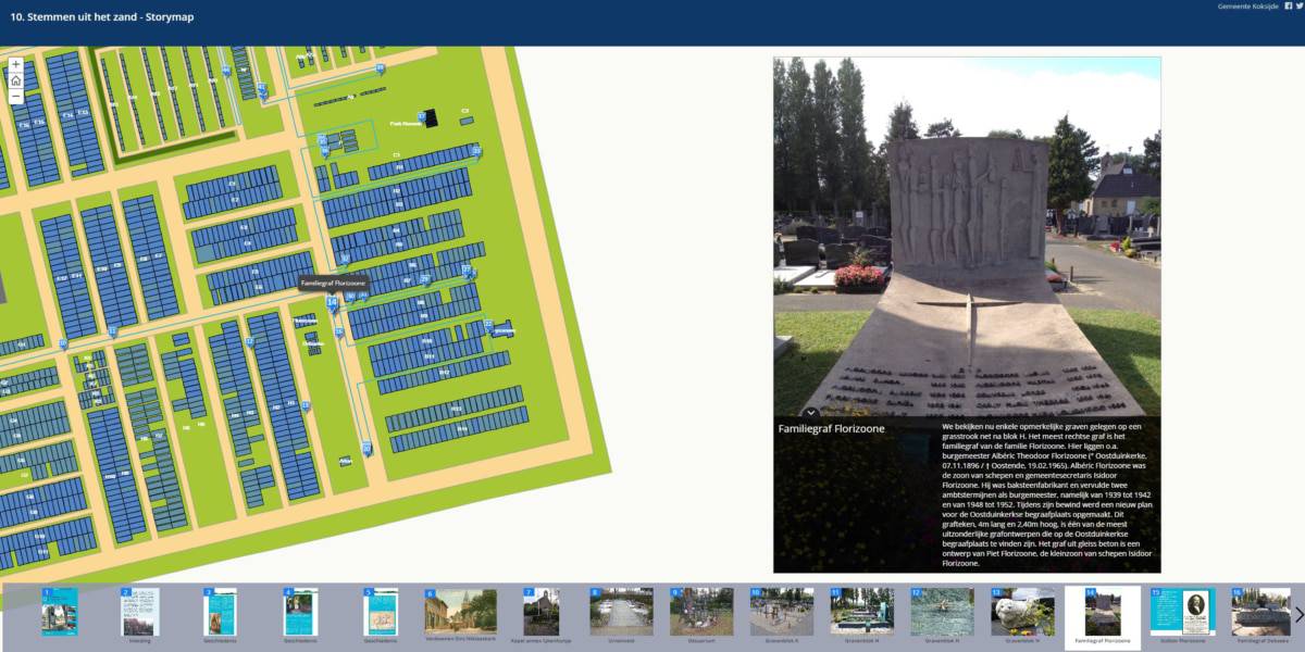
Week of the cemeteries
Storymap During the week of the cemeteries, at the end of May and beginning of June 2018, the Culture and Heritage Office of [...]

Virtual tours 3D at Begeo
Virtual tour Be sure to visit us at the BeGeo fair, where we can show you the wonderful world of 3D. Come along [...]

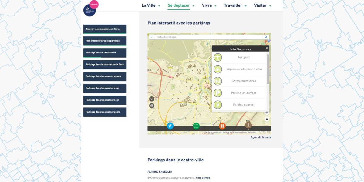
Geo-hub Ville de Luxembourg
GEO-HUB The Ville de Luxembourg has built up an extensive geo-hub in which numerous geo-information can be found for its citizens and visitors. [...]