
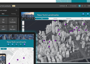
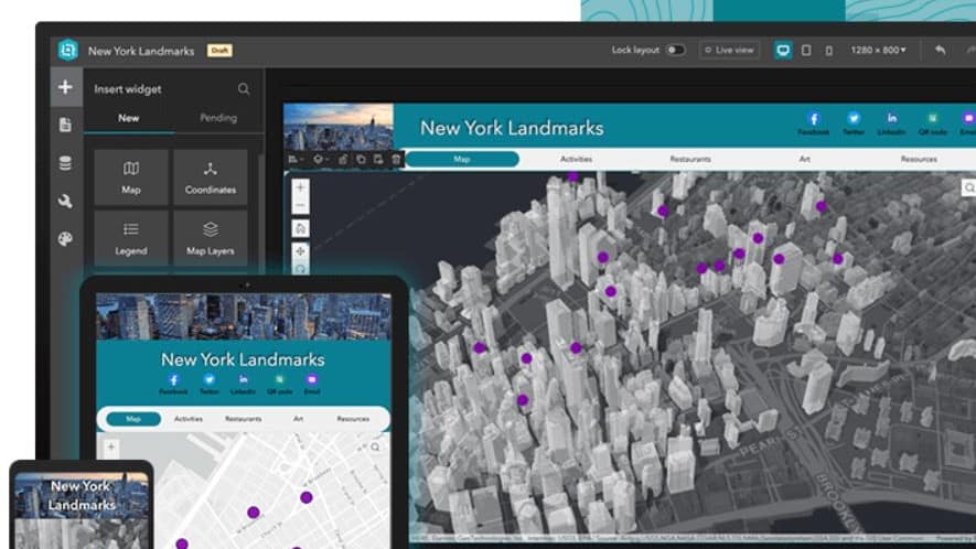
Building Web Apps with ArcGIS Experience Builder
Learn how to build immersive web apps that take advantage of modern web design principles without writing code. This course shows how to interactively create, configure, and publish mapcentric and datacentric web apps that feature your organization's content.

Get Started with ArcGIS Arcade
Enable customized content across the ArcGIS system. Discover the unique role of the Arcade expression language within ArcGIS and explore concepts that underlie writing and executing Arcade expressions that can be used across the ArcGIS system (ArcGIS Online, ArcGIS Pro, ArcGIS Enterprise, and ArcGIS apps).
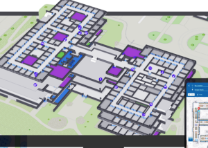
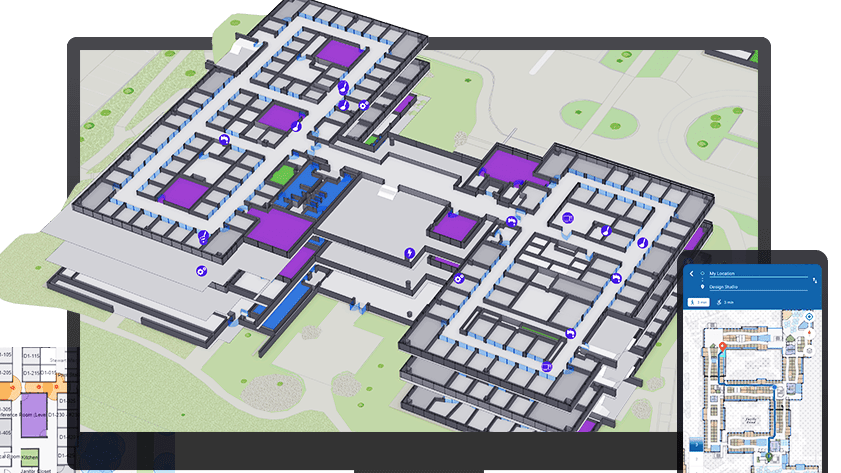
Introduction to ArcGIS Indoors
This course introduces key workflows to successfully deploy ArcGIS Indoors. Learn how to create and maintain a complete system for indoor mapping and data management that lets your organization share smart building maps.
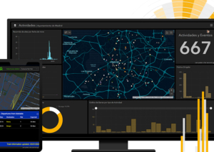
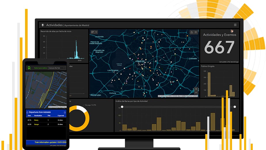
Working with ArcGIS Dashboards
Learn how to present data simply and effectively to monitor key metrics and activities in progress and provide decision-makers with easy access to the data that matters most to them. This course covers the essential concepts and workflows you need to understand to create an ArcGIS Dashboards dashboard from scratch, configure it to meet your data users' needs, and share it with stakeholders.

ArcGIS Online: Essential Workflows
This course introduces web maps, apps, and other authoritative content that may be available through your ArcGIS Online organizational site. You will learn how to discover, use, create, and share content that infuses projects with geographic context, additional business intelligence, and visual impact.

ArcGIS Enterprise : Administration workflows
Master techniques to configure and maintain an ArcGIS Enterprise solution that meets your organization's business needs. You will learn about ArcGIS Enterprise architecture, server licensing roles and extensions, and the capabilities that support common GIS patterns of use. Best practices to manage servers, data, and services while ensuring system performance over time are covered.

Creating Python Scripts for ArcGIS
This course teaches how to access the Python environment in ArcGIS Pro, script common data management tasks, and automate geoprocessing workflows.

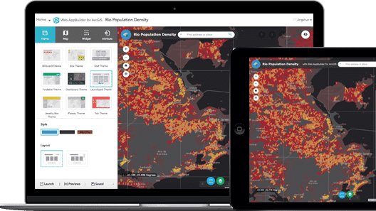
Configuring Web Apps Using Web AppBuilder for ArcGIS
Learn how to easily create intuitive, focused web apps that are accessible on desktop and mobile devices—without writing any code.

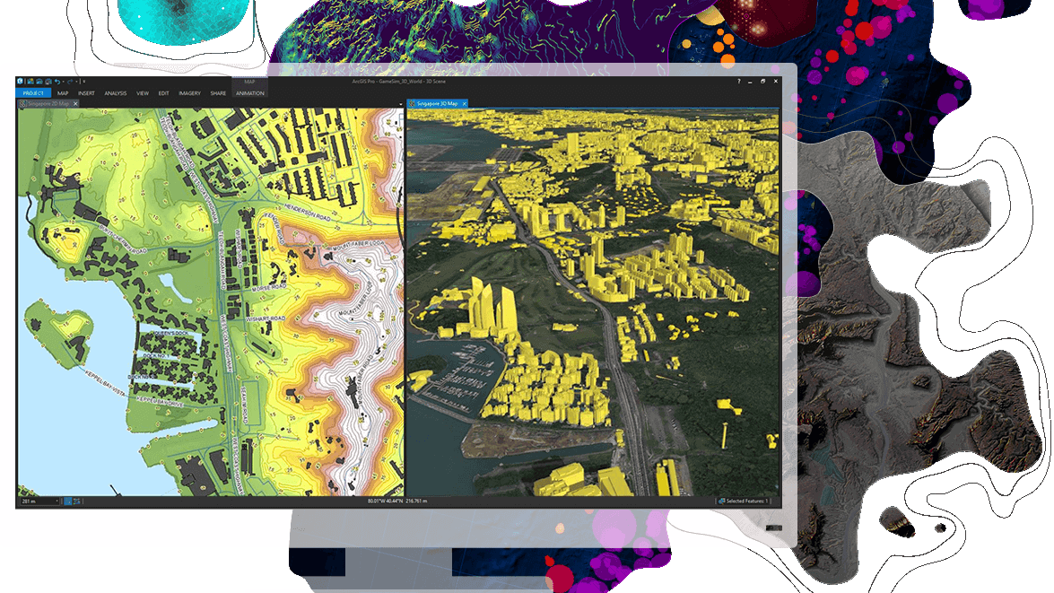
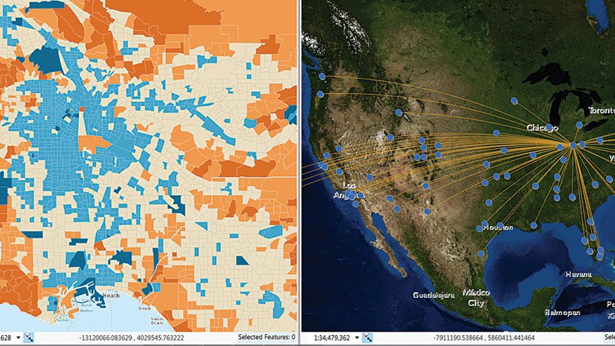
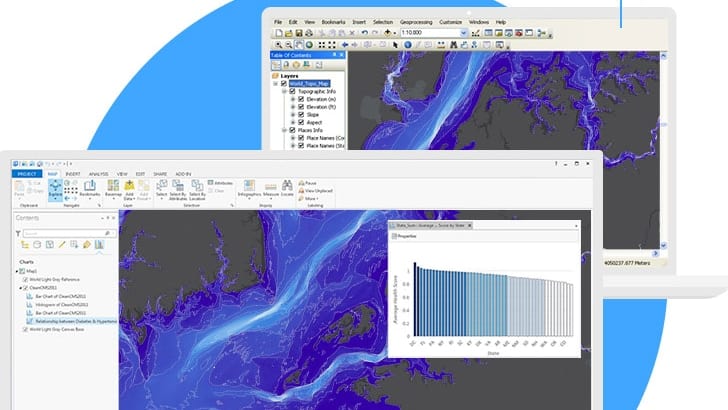
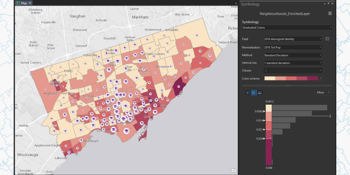
Mapping and Visualizing data in ArcGIS
Learn fundamental cartographic design principles and a standard workflow to produce print and online maps tailored to their purpose, medium, and intended audience. This course teaches ArcGIS Pro techniques to create and share a variety of professional-quality information products including print maps, web maps, 3D scenes, animations, and charts.

Location Analytics Using ArcGIS Insights
This course prepares you to work with Insights for ArcGIS to dynamically visualize and analyze data from multiple sources on maps, charts, tables, and more.

Image analysis with ArcGIS
Learn best practices and workflows to enhance visualization and extract meaningful information from satellite imagery, lidar, and other remotely sensed data.

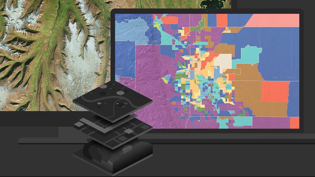
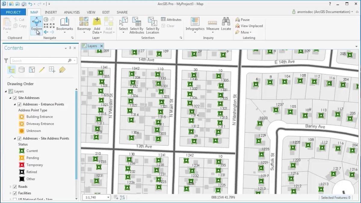
Managing geospatial data in ArcGIS
This course takes you on an in-depth exploration of the geodatabase, the native data storage format for ArcGIS software. Best practices to create a geodatabase to centrally store and efficiently manage your organization's authoritative geospatial data are covered.

Creating and editing data with ArcGIS Pro
This course teaches best practices to create accurate geographic data and maintain it over time.

ArcGIS Enterprise : configuring a base deployment
Learn how to install and configure an ArcGIS Enterprise base deployment to enable individuals to securely access, create, and share geospatial resources to boost collaboration and gain location-based insights.

Migrating from ArcMap to ArcGIS Pro
This course is for ArcMap users that wish to migrate to ArcGIS Pro. This hands-on course will familiarize you with essential ArcGIS Pro terminology and prepare you to efficiently complete many different tasks related to visualization, editing, geoprocessing, and analysis.

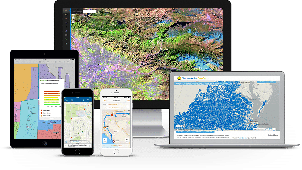
Field Data Collection and Management using ArcGIS
This course focuses on the configuration of the ArcGIS platform for field data collection and how the ArcGIS apps for the field work together.

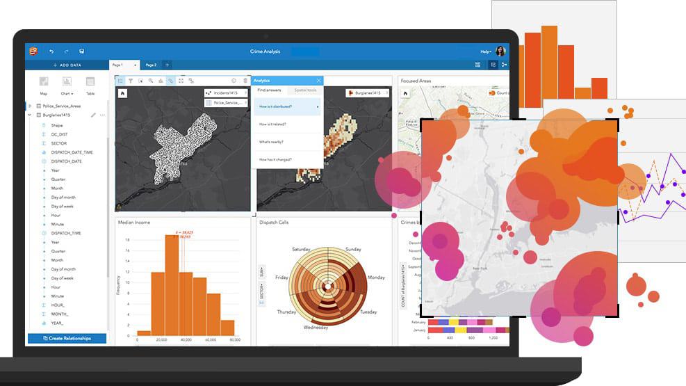
Spatial Analysis using ArcGIS Pro
Learn essential concepts and a standard workflow you can apply to any spatial analysis project. You will work with a variety of ArcGIS tools to explore, analyze, and produce reliable information from data.

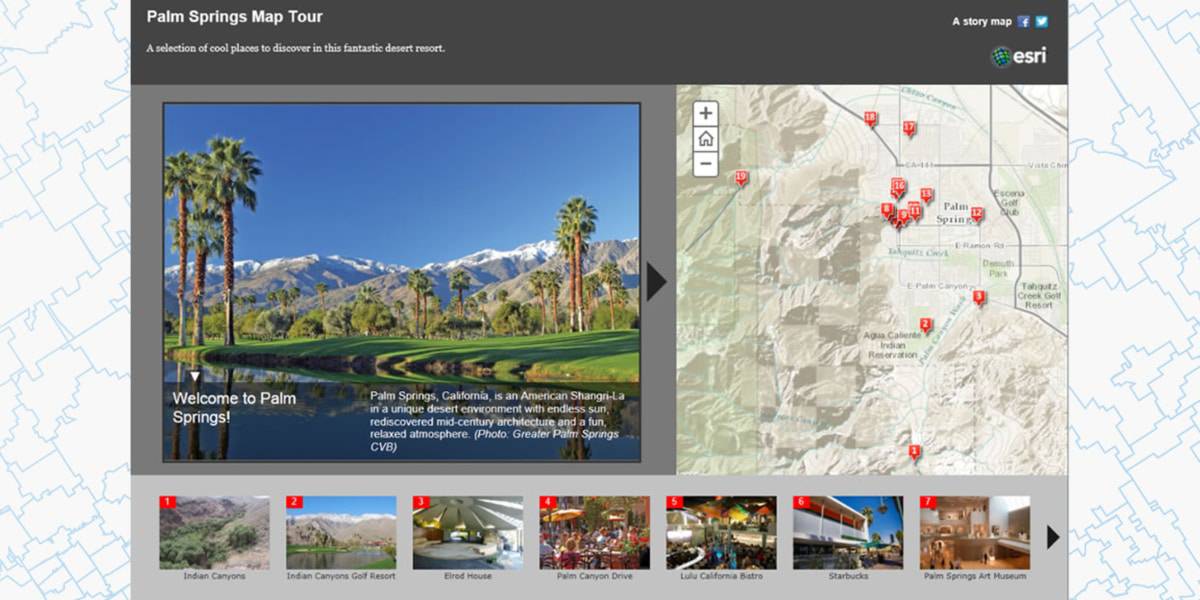
Creating stories with ArcGIS
Thanks to their engaging user experience, story maps have achieved mass appeal as a vehicle to inform the public, engage stakeholders, and inspire an audience. This course is for anyone that wants to communicate with maps—teaches the concepts, best practices, and decisions that need to be made when creating and sharing a story map.

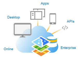
Putting ArcGIS to use across your organization
Get a comprehensive introduction to ArcGIS platform components and capabilities. Discover how the ArcGIS platform helps organizations address common business challenges and apply location-based insights to streamline operations and improve decision making.

ArcGIS Pro: Essential Workflows
Extend your foundational GIS knowledge, get comfortable with the ArcGIS Pro application, and explore some of the most common GIS workflows. This course introduces techniques and general best practices to map, manage, analyze, and share data and other GIS resources.

Introduction to GIS Using ArcGIS
This course introduces GIS concepts and ArcGIS tools used to visualize real-world features, discover patterns, and communicate information. This course is for new ArcGIS users.

Sharing content to ArcGIS Enterprise
This course prepares you to share geographic content so it is accessible to everyone who needs it, when they need it, however they want to access it.

Working with CAD Data in ArcMap
Like GIS data, CAD data is commonly used in design, engineering, and planning workflows. In this course, you will learn how to efficiently display CAD data with GIS layers in ArcGIS, use CAD data directly in ArcGIS geoprocessing and analysis operations, and import CAD data into a geodatabase.
Wat zijn de voordelen van een webinar?
U verlies geen tijd, u volgt immers de webinar van achter u computer.
Geen reiskosten en verblijfkosten.
Deelname is gratis, je hebt enkel een computer en een internet connectie nodig.